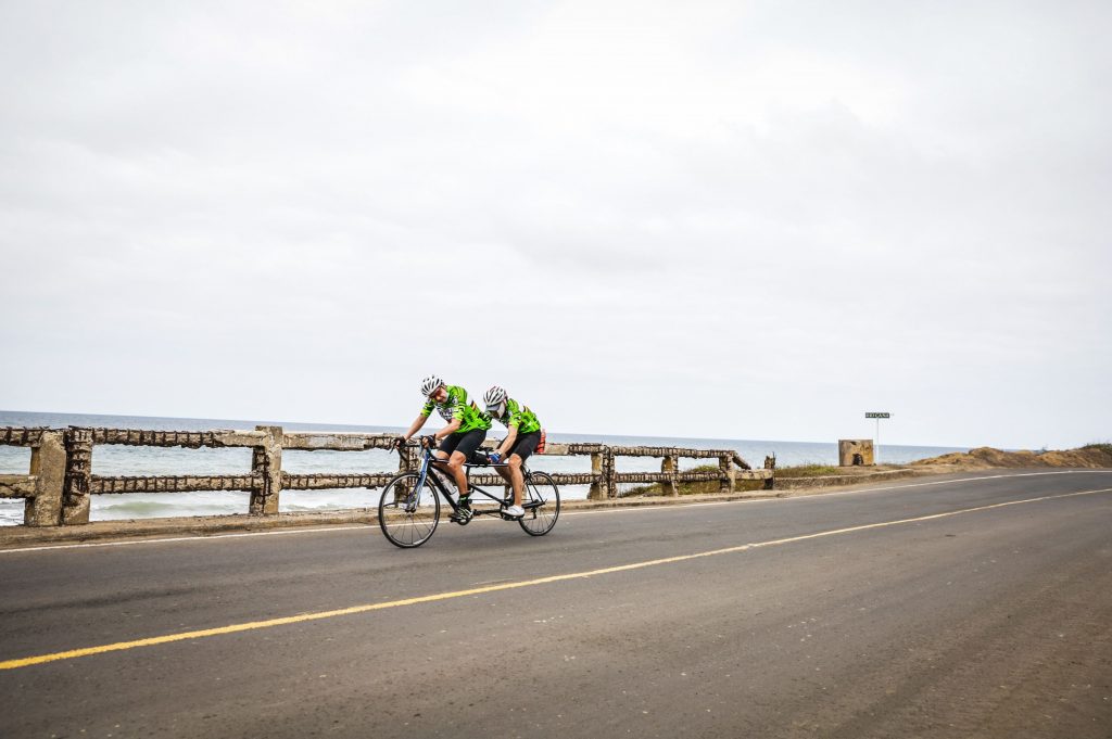
GFNY Ecuador Manta Course Guide

With race day at GFNY Ecuador approaching, it’s time to get familiar with the course and start thinking about how you’ll tackle race day. It’s always worth some time to learn a bit about the race course you’ll be taking on, and prepare yourself mentally for the challenges to come. Strategy, nutrition, and pacing are all important concerns on race day, but they can only be done with proper knowledge of the course.

GFNY Ecuador

GFNY Ecuador is returning to the beautiful Pacific Coast city of Manta for the 3rd year in a row. The city of Manta’s Pacific Coastline is the last stop on land before the storied Galapagos Islands, and a natural wonder in its own right with amazing beaches and mountain rain forests. But in spite of all its natural beauty and all that Manta has to offer, the GFNY Ecuador course is very challenging.  With some slight changes to the 2020 course, the 2021 course will be the best of all of the cycling challenges that Manta has to offer.

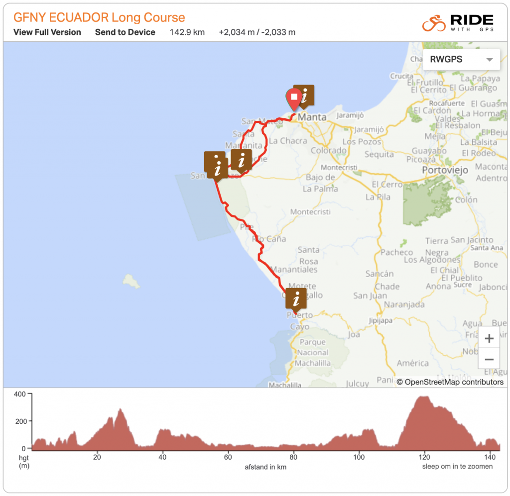
The 150 kilometer course has over 2,000 meters of climbing, so it will not be a “flat beach day”. The riders will have some wind challenges along the coast, but the main features of the course will be the rolling hills, the short but steep climbs, and the final 10 kilometer climb (known as “El Aromo”) before descending back to the coastline and the finish. So, let’s take a closer look at the course to help inform riders on how to tackle this natural wonder.
 

The Start

GFNY Ecuador starts in Manta close to Playa Murciélago, riding through a slightly rolling  7 kilometers the peloton will leave the sounds of the city of Manta behind them. Over the next 22 kilometers riders will want to stay focused to keep with the front groups, as the short rollers, while not steep, will separate the riders that are not paying close attention to the wheels in front of them.

The course will hug the Pacific Coastline here, and as with any coastal ride, staying with a group to fight the wind together will be the best move. Riders will know they are focused if they can stay with the group, but if and when the peloton starts to split, it will be best for riders to find a group that fits their pace and stay with that group to conserve energy for the long course ahead. Riders should grab a wheel and save their matches for later when they are really needed. 

Descending 7 kilometers now will take the riders to San Lorenzo where there will be an aid station and the ability to refill bottles and take on food like nutrition bars or fruit. Riders should be sure to maintain their hydration and fuel throughout this challenging course. 
 

San Lorenzo to Puerto Cayo

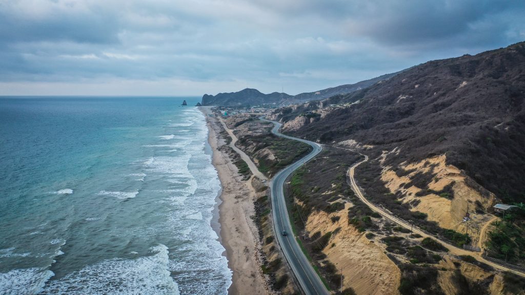
Upon leaving San Lorenzo, the riders will face a flat, but windy five kilometer stretch that is best managed by riding with a group. Staying with a group that matches each riders pace will ensure that riders don’t have to face the wind alone and use energy that will be needed later in the course. For this stretch of the course, riders will want to be on the left side of the rider in front of them to maximize the draft in the side wind.

For this part, it will be at the left side of the person in front of you. 40 kilometers into the race, the riders will face a 2 kilometer hill with some steep sections hitting up to 8% grades. These sections are short, so riders can attack these short bursts and still have some energy for later. With some rollers ahead, the 5 kilometers into the turn around are flat, but with wind from the coast. An aid station at the turnaround will allow riders to refuel and maintain their energy into the second half of the course. Riders should take advantage of this opportunity to continue to hydrate and take on additional food if needed.

Back to San Lorenzo

Heading back along the same road toward San Lorenzo now, there will be the same five kilometer flat section when leaving Puerto Cayo, and before heading inland where the terrain will be gin to roll again. A short and steep descent will take the riders back into San Lorenzo where the final push to the finish will begin. 

El Aromo

After leaving San Lorenzo the second time, riders will face the biggest challenge of the day, in conquering El Aromo. At 7.5 kilometers long and an average gradient of 5.2% El Aromo will take the riders high above the coast, with steep pitches upwards of 13%. With over 115 kilometers in the legs when riders arrive at El Aromo, these steep sections will feel even steeper. 

Those riders fighting for a top result should be thinking about the challenge of El Aromo all day, saving their legs and preparing to put attacks in on the steep pitches.. Riders further back should be making sure to save some energy for the big push before the long descents to the finish. 

Get ready to finish

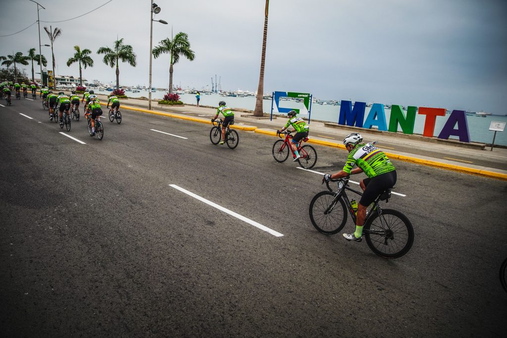
When reaching the top of El Aromo, riders will still need to push some big effort before the reward of the descent. The exhilarating descent that brings you back to San Mateo is almost 20 kilometers long but not that steep, so riders should get that chain on the big ring and go full gas. The last 10 kilometers to the finish line bring riders back along the same coastal roads that the race started on.

The rolling hills along the Pacific Ocean will be the last obstacle before reaching Manta where your family and cycling friends will be waiting for you to celebrate an amazing day.  It’s even rumored that there could be a tailwind. (NO, THAT CAN’T BE RIGHT)!
 

Tags: ,

Guía del Recorrido de GFNY Manta

GFNY Ecuador

GFNY Ecuador regresa a la hermosa ciudad de Manta en la costa del Pacífico por tercer año consecutivo. La ciudad de la costa del Pacífico Manta es la última parada en tierra antes de las históricas Islas Galápagos, y una maravilla natural por derecho propio con increíbles playas y bosques tropicales de montaña. Pero a pesar de toda su belleza natural y todo lo que Manta tiene para ofrecer, la ruta de GFNY Ecuador es muy desafiante. Con algunos pequeños cambios en la ruta de 2020, la ruta de 2021 será el mejor de todos los desafíos de ciclismo que Manta tiene para ofrecer.

El recorrido de 150 kilómetros tiene más de 2.000 metros de desnivel, por lo que no será un “día plano en la playa”. Los ciclistas tendrán algunos desafíos de viento a lo largo de la costa, pero las características principales del recorrido serán las colinas, las subidas cortas pero empinadas y la subida final de 10 kilómetros (conocida como “El Aromo” antes de descender de nuevo a la costa). 

Por lo tanto, echemos un vistazo más de cerca al recorrido para ayudar a informar a los ciclistas sobre cómo abordar esta maravilla natural.


El comienzo

GFNY Ecuador comienza en Manta cerca de Playa Murciélago, recorriendo 7 kilómetros ligeramente ondulados donde el pelotón dejará atrás los sonidos de la ciudad de Manta. Durante los próximos 22 kilómetros, los ciclistas querrán mantenerse concentrados para permanecer con los grupos delanteros, ya que las suaves y cortas colinas, aunque no empinadas, separarán a los ciclistas que no presten mucha atención a los ciclistas delante de ellos. La ruta abrazará la costa del Pacífico aquí, y como en cualquier paseo costero, quedarse con un grupo para luchar juntos contra el viento, será la mejor decisión. Los ciclistas sabrán que están concentrados si pueden permanecer con el grupo, pero si el pelotón comienza a dividirse, será mejor que los ciclistas encuentren un grupo que se adapte a su ritmo y se queden con ese grupo para conservar energía durante el recorrido largo adelante. Los ciclistas deben ir a rueda y guardar sus energías para cuando realmente las necesiten.

Descendiendo 7 kilómetros, ahora los ciclistas llegarán a San Lorenzo donde habrá un puesto de abastecimiento y la posibilidad de rellenar ánforas/bidones y tomar alimentos como barras o frutas. Los ciclistas deben asegurarse de mantener su hidratación y combustible durante este desafiante recorrido.


San Lorenzo es Puerto Cayo

Al salir de San Lorenzo, los ciclistas afrontarán un tramo de cinco kilómetros llano, pero con mucho viento, que se controla mejor en grupo. Permanecer con un grupo que coincida con el ritmo de cada ciclista garantizará que los ciclistas no tengan que enfrentarse solos al viento y utilizar la energía que necesitarán más adelante en el recorrido. Para este tramo del recorrido, los ciclistas querrán estar del lado izquierdo del ciclista frente a ellos para maximizar la ventaja en el viento lateral.

A los 40 kilómetros de carrera, los ciclistas se enfrentarán a una colina de 2 kilómetros con algunas secciones empinadas que alcanzan pendientes del 8%. Estas secciones son cortas, por lo que los ciclistas pueden atacar estas ráfagas cortas y aún tener algo de energía para más adelante. Con algunas ondulaciones por delante, los 5 kilómetros de vuelta son planos, pero con viento de la costa. Un puesto de abastecimiento en el cambio de sentido permitirá a los ciclistas abastecerse y mantener su energía en la segunda mitad del recorrido. Los ciclistas deben aprovechar esta oportunidad para seguir hidratándose y consumir alimentos adicionales si es necesario.


Volver a San Lorenzo

Volviendo ahora por el mismo camino hacia San Lorenzo, tendremos el mismo tramo llano de cinco kilómetros al salir de Puerto Cayo, y antes de dirigirse hacia el interior donde el terreno estará listo para rodar nuevamente. Un descenso corto y empinado llevará a los ciclistas de regreso a San Lorenzo, donde comenzará el empujón final hacia la meta.


El Aromo

Tras dejar San Lorenzo por segunda vez, los ciclistas afrontarán el mayor desafío del día, conquistar El Aromo. Con 7,5 kilómetros de longitud y una pendiente media del 5,2%, El Aromo llevará a los ciclistas muy por encima de la costa, con pendientes empinadas superiores al 13%. Con más de 115 kilómetros en las piernas cuando los ciclistas lleguen a El Aromo, las secciones empinadas se sentirán aún más empinadas.

Aquellos ciclistas que luchan por un resultado deberían estar pensando en el desafío de El Aromo todo el día, guardando sus piernas y preparándose para atacar en las pendientes empinadas. Los ciclistas más atrás deberían asegurarse de ahorrar algo de energía para esta subida antes de los largos descensos del final.


Prepárate para llegar 

Al llegar a la cima de El Aromo, los ciclistas aún deberán hacer un gran esfuerzo antes de la recompensa del descenso. El emocionante descenso que te lleva de regreso a San Mateo tiene casi 20 kilómetros de largo pero no tan empinado, por lo que los ciclistas deben colocar esa cadena en el plato grande y acelerar a fondo. Los últimos 10 kilómetros hasta la línea de meta llevan a los ciclistas de regreso por las mismas carreteras costeras en las que comenzó la carrera. Las colinas a lo largo del Océano Pacífico serán el último obstáculo antes de llegar a Manta, donde tu familia y amigos ciclistas te estarán esperando para celebrar un día increíble. Incluso se rumorea que podría haber viento a favor. (NO, ESO NO PUEDE SER CORRECTO)!


Tags: ,